France
On the website templiers.net a host of templar sites in France and their history is described in great detail. The same is true for the Project Beauceant website on templiers.org. Regrettably, these websites differ in detail, number and location of commanderies presented. Furthermore, locating the indicated sites on modern maps is hardly possible in the first case and rather difficult in the second.
Therefore, TemplarsNow runs a project which pinpoints the geographical
location of Templar sites in France on a modern Google-map.

The French maps are being constructed by combining the information of both websites mentioned above and plotting it on modern Google-satellite maps, one per Department. In the process, the geographical location of each site is checked, if necessary, on the IGN-maps and Cassini-map and other sources on the internet.
Primary source is the templiers.net website. Additional information is used from the templiers.org website and from other sources on the internet. The site description on the maps uses snippits of text (for now in French) and photographs, mainly from the templiers.net website. Other sources such as the French Wikipedia websites, and other sources mentioned therein, are used as cross reference and for additional information. If such information is presented, the sources are indicated.
The illustration above presents a part of the resulting map for the Creuse Department (23). All completed maps are to be found on this dedicated page.
Netherlands
On his website http://www.tempelieren.nl (in Dutch) Dr Ben Brus embarks on a painstaking journey to identify sites of former settlements of the Knights Templar in The Netherlands.
TemplarsNow has plotted the certain and probable sites identified by Dr Brus on a modern Google-map. This map is shown below, but can also be found on this dedicated page which contains important additional information on the sources and methods applied.
BELGIUM AND LUXEMBOURG
In his book on the Knights Templar (De tempeliers - de tempelorde tijdens de kruistochten en in de Lage Landen", in Dutch, translation title: The Knights Templar - the Order of the Temple during the crusades and in the Low Lands) Jan Hosten lists many sites of (former) commanderies, Templar houses and farms, and smaller possessions such as lands or rights in Belgium, Luxemburg and northern France.
The
locations mentioned in the book have been summarized by TemplarNow on the Google Map below. The map including important additional information on the sources and methods applied, can also be found on this dedicated page.
source: Jan Hosten 2006: De tempeliers - de tempelorde tijdens de kruistochten en in de Lage Landen" (in Dutch, translation title: The Knights Templar - the Order of the Temple during the crusades and in the Low Lands); ISBN-13 978-90-430-1061-0; Publ Pearson Education Benelux, Amsterdam
Other maps
 |
| source |
 |
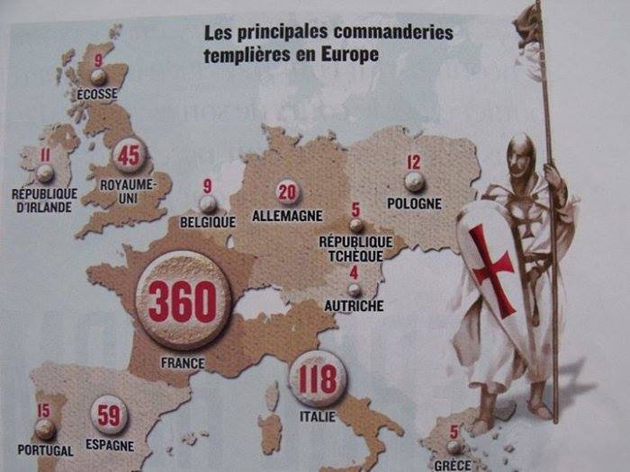
| Knight Templar Commanderies in Europe ca 1300 source |
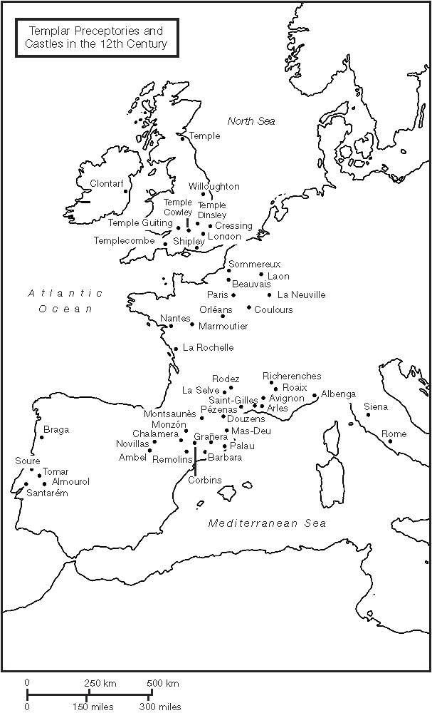 |
| source |
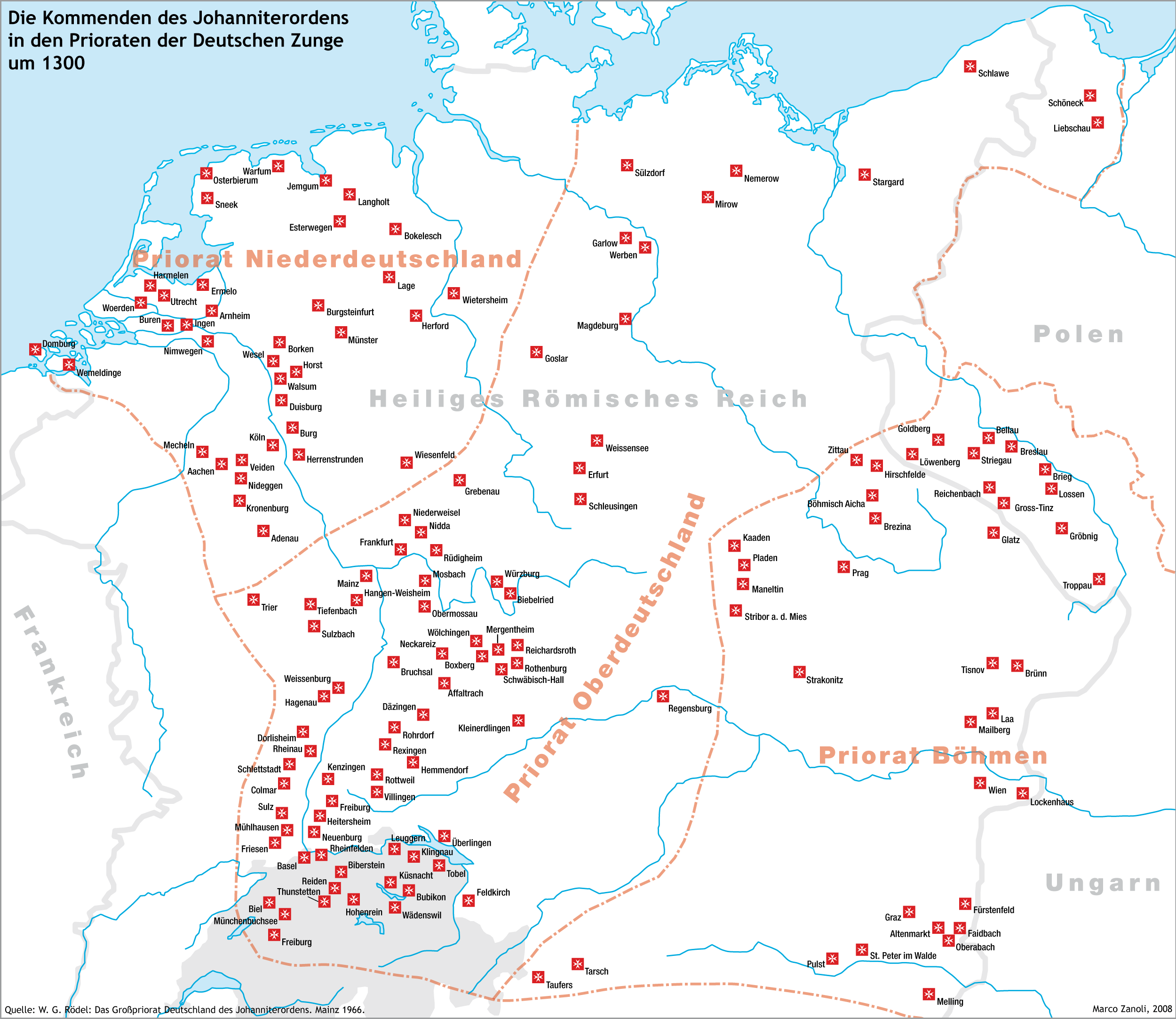 |
| Commanderies of the Johanniter Order 1300 source |
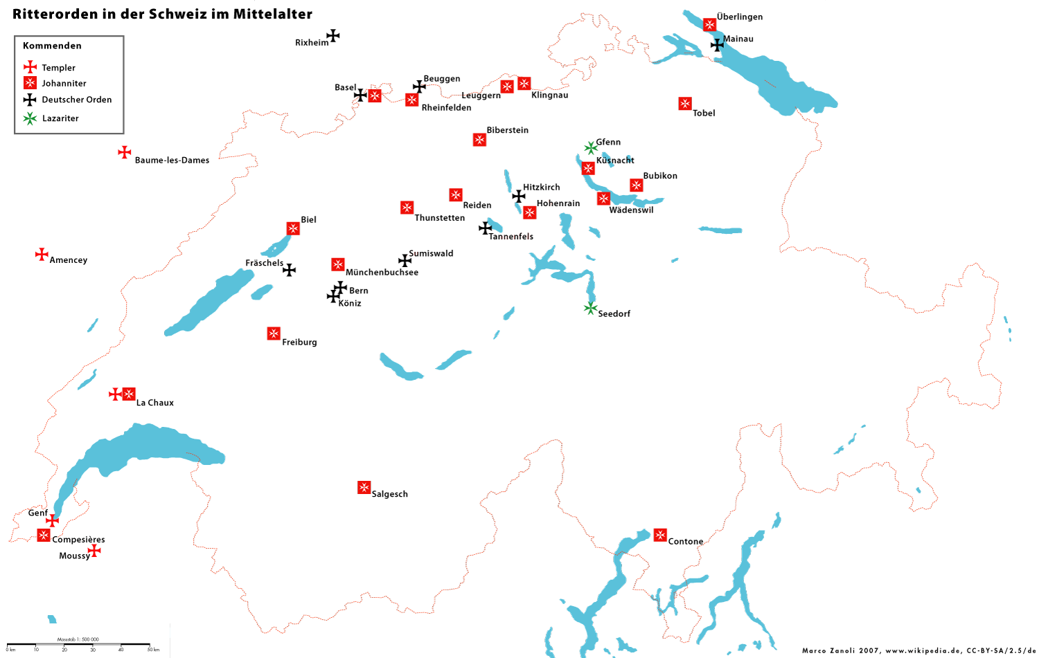 |
| Commanderies of several Knights Orders in Switserland source |
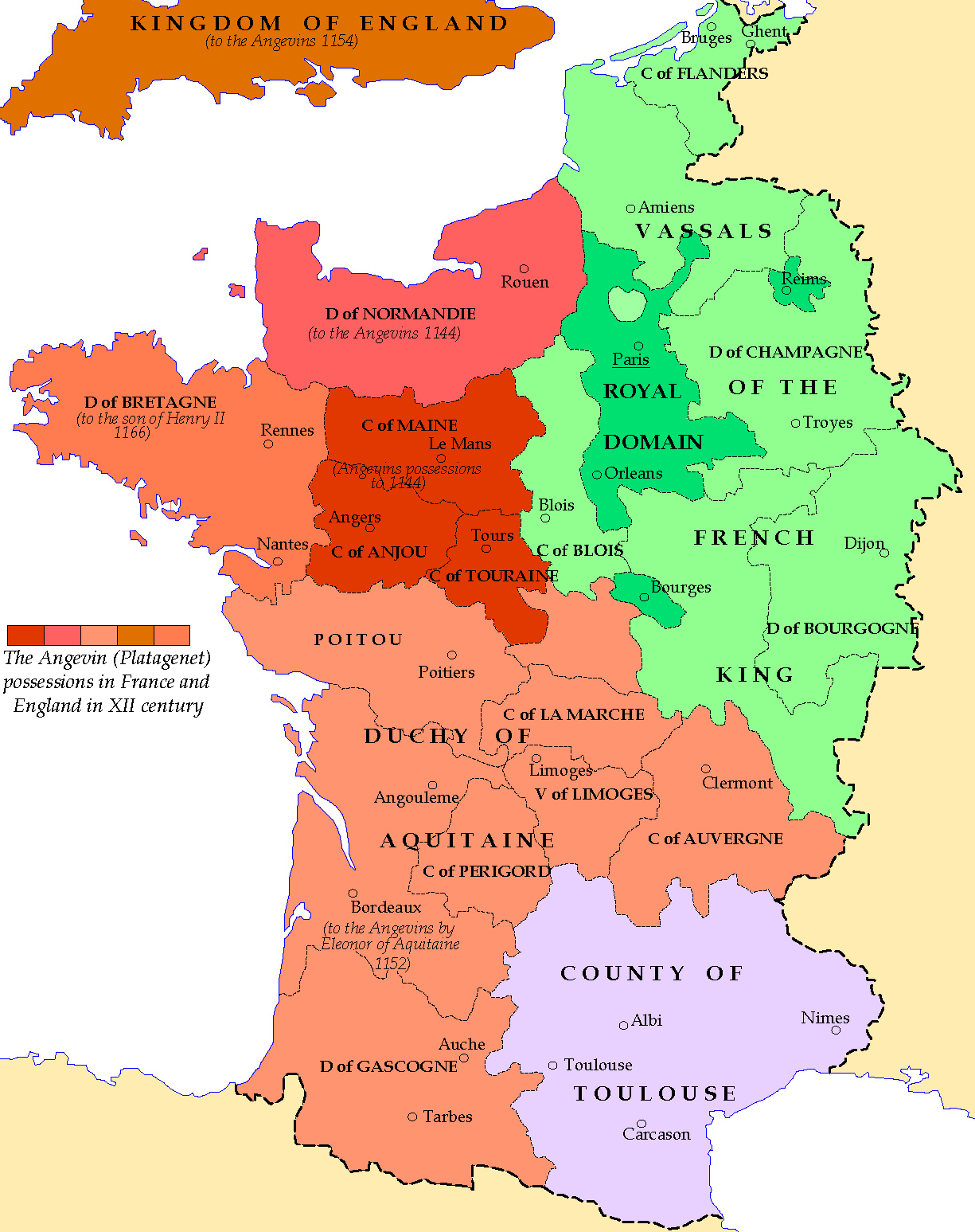 |
| France 1154 |